Image
Lihou History Header

Lihou Island Museum
& Education Centre

Lihou is a small tidal island with a rich
history dating back thousands of years.

Lihou Timeline

Hand drawn illustration of hunter‐gatherers

The Earliest Settlers

  • Ancient Inhabitants

    People first made Lihou Island their home many thousands of years ago. They lived close to nature, using local resources to build shelter and find food.

  • Hunter-Gatherers

    These early settlers fished and foraged for their meals. Their simple, resourceful way of life shows how they adapted to the island’s natural environment.

  • Clues from the Past

    Archaeologists have found stone tools and other remains that help us learn how these first people lived and worked on the island.

Hunter‐Gatherers

Archaeologists have found evidence to show that the first people on Lihou were from the Mesolithic period. We know them as hunter‐gatherers from the prehistoric age. They have found their tools, but not their shelters and homes as these were made out of skins, furs and other materials which have not survived to the present day.

Archaeological Digs

There have been several excavations on Lihou since Victorian times. The Mesolithic site has been monitored and partially excavated since the 1990s. One dig was even televised. Whilst there are numerous Neolithic burial sites on Guernsey, there is only evidence of medieval burials on the island of Lihou.

   Skeletons unearthed at a medieval grave on Lihou Island
Skeletons unearthed at a medieval grave on Lihou Island
   Skeletons unearthed at a medieval grave on Lihou Island
Skeletons unearthed at a medieval grave on Lihou Island

Flints

Flints collected from prehistoric sites on Lihou in 1963 and 1966. They were used by hunter‐gatherers over 10,000 years ago. You can see how robust and sharp some of the edges are. They had many uses.

Flints collected from prehistoric sites on Lihou in 1963 and 1966

Early Man – A History

Homo erectus, one of the earliest human species, started entering Europe in groups of hunter‐gatherers from Africa 1.8 million years ago, but it took several waves of migration before they permanently established a presence about 1 million years ago. They weren’t well adapted to the cold of Ice Age Europe and so lived in the south of the continent where it was warmer and drier. By 1 million years ago, they had spread into northern Europe, though they often would only stay in the north during the summer. Some may have lived on or near Lihou – at that time sea levels were much lower and you could walk from England to France via Guernsey and Lihou. Archaeologists have found their tools, weapons, and firepits but their shelters and homes were made out of skins, furs, and other materials which have not survived to the present day.

During the Ice Age, not everywhere was permanently inhabited because Europe would freeze over and be covered in glaciers for hundreds or thousands of years, which caused early humans to move back south to Africa or east to Asia until the glaciers melted and they could return to hunt woolly mammoths, woolly rhinoceros, steppe bison, elk, and deer.

Homo heidelbergensis, another human species which had evolved from Homo erectus, entered Europe from the south 850,000 years ago. 200,000 years ago, they went extinct due to a sharp change in climate to which they could not adapt.

Homo neanderthalensis (“Neanderthals”) emerged approximately 400,000 years ago in Europe and northern Asia. They were better adapted to survive in cold climates but never had a large population, which meant that natural selection was not as effective and they were more vulnerable to changes in their environment. They went extinct 40,000 years ago, with archaeologists still debating whether it was due to modern humans, climate change, disease, or something else. They have historically been portrayed as dim-witted and slow, but modern archaeologists have disproven this.

Homo sapiens sapiens (modern humans like us) entered Europe from Central Asia and the Middle East a few thousand years before the Neanderthals disappeared. These humans were less adapted to the cold climate but were more numerous and innovative.

The Priory

  • A Sacred Beginning

    Built in the 12th century by Benedictine monks, the priory was a special place for prayer and community.

  • Challenging Construction

    Creating a monastery on a remote, tidal island was no easy feat. The monks used local stone and worked hard to build a place of worship.

  • Remnants of the Past

    Today, only the ruins remain. They remind us of the modest life that was once lived here, connecting us to the island’s long history.

The Priory

Lihou is the site of a twelfth-century Benedictine Priory. Over the years it has been known by several names: Lihou Priory, The Priory of St Mary of Lihou, and The Priory of Notre Dame de Lihou. It now lies in ruins with only the remains of some of its walls surviving. In its day it would have been a dominant structure on the particularly low-lying island, and would have been clearly visible from the L’Erée headland on the Guernsey mainland and to passing vessels.

Lihou Priory circa 1900
Reconstruction of the Priory by Meet The Ancestors

Why build a monastery on Lihou?

When attempting to wonder why the monks, who built the famous cathedral at Mont St Michel, Brittany and St Michael’s Mount in Cornwall, also chose to build a Priory on Lihou, it is useful to note that an island studies scholar, Philip Hayward, commented in connection with his study of the comparable tidal island of St Michael’s Mount: “There is a common association of remote, inaccessible and minimally inhabited places with spiritual ‘energies’ and related senses of holiness” . The same could be said for Lihou, which may be one of the reasons which drew the monks to the island. The Priory was not as grand nor as high as the churches found in Mont Saint Michel or St Michael’s Mount, however its build must have been a logistically challenging one.

Lihou Priory circa 1900

History of the Priory

Having stood for several centuries, the Priory was dissolved in 1536 when Henry VIII disbanded monasteries, and the Priory’s physical demise finally came in 1759 when the then Governor of Guernsey, Lieutenant-General John West, ordered that the Priory be destroyed to prevent Lihou being a possible landing point for attack by the French during a period of Anglo-French hostility. At this time, during the Seven Years’ War (1756–63), Guernsey and the other Channel Islands existed under the ever-present threat of attack by the French and were heavily fortified by the English.

Human remains found during excavation

The building of the Priory

Limestone imported from Caen in France was used to build and decorate the Priory. At the time Guernsey was part of the Duchy of Normandy and it remained as such until 1204 (when it is argued that it should remain in the King of England’s possessions as it was when he was also Duke of Normandy).

Limestone used in the Priory was not only quarried in Caen, it was also cut, shaped and decorated outside Caen by Norman stone masons. Some of the patterns are quite intricate. The pre-fabricated stone was then shipped from Caen to Lihou by boats not dissimilar to the boats used by William the Conqueror in 1066. Archaeologists have also found ornate tiles that were also used to decorate the inside of the building. We have examples of these in the Lihou Island Museum and Education Centre. There are also some examples of the carved stone in Lihou House and also at Candie Museum.

Stone head found at Lihou Priory

Life at the Priory

Life in the monastery was not harsh and the monks appeared to have a plentiful supply of fresh fish in their fish traps (see below) and evidence of a wine consumption has also been found. It would also appear that many people from all over came and visited the island and this is evidenced by the amount of foreign coins that have been found on the site.

Recent discoveries from digs relating to the medieval period on Lihou have been made which show medieval Lihou in a very different light to one depicting a frugal monastic living. In 1999, the programme, Meet the Ancestors, assisted in excavations led by the States at the Priory. What they found was unexpected and startling. Fifteen human skeletons were discovered buried there. Five of these, including a child, were interred beneath the nave of the Priory. Of the remainder, three lay outside the walls (indicative of suicides) and two were buried in stone-lined pits.

Excavation in 2000
Priory excavation in 2000

One of the skeletons was that of a middle-aged male, dated to having been born around 1250. He was found to be suffering from syphilis. Small children, and sufferers from sexual diseases are not the normal incumbents of dedicated monastic graveyards. Certainly, the general conduct of the Priory inhabitants on Lihou seemed to not always be exemplary, with stories of the monks cavorting with local girls and dabbling with witchcraft.

Monk reconstruction
Monk reconstruction

Bibliography and useful links

Medieval Coins

  • Diverse Origins

    Coins and tokens discovered at the Priory show a range of designs and inscriptions, indicating they were produced in different regions - including England, France, and beyond.

  • Historical Insight

    Most of the coins have been dated to the active period of the Priory, helping researchers to establish a timeline for the site's history.

  • Findings

    These finds form an important part of Lihou’s documented heritage, providing concrete evidence of the monetary practices during medieval times.

Coins and the Monetary Economy

Ancient coins have been found from many countries at the Priory. Most date from when the Priory was a fully functioning institution. Please see the interactive wall at Lihou for some of the finds.

Display of ancient coins found at the Priory

Finds of medieval coins have been made at a number of excavations, though the urban centres of St Helier and St. Peter Port have only produced a few medieval coins, with two from the medieval house at Old Street, St. Helier (McCammon 1984). More have been recovered from Lihou Priory (Sebire 2000). The few metal-detecting coin or token finds have been from the very late medieval or early modern period. Coins and tokens come not only from England but also from France and elsewhere in Europe, reflecting changing political relations and the international connections more obviously seen in the ceramics.

The complexity of financial transactions and the variety of currencies used in the documentation reflect a very mixed coinage, but remarkably little has been recovered, given the expected intensity of use at least in the ports, where international trade and taxation should have enabled and required a fully monetised economy. There is little evidence that the periods of political and military instability and raids encouraged the burial of hoards, unless the damage was much less than implied in some of the documentary sources and they were generally recovered.

Medieval coins discovered at Lihou
An example of medieval coins discovered at Lihou

The overall impression, therefore, is that the monetary economy was socially and geographically restricted for most of the Middle Ages on the Channel Islands, though this needs testing with excavation on a wider range of settlement types. One might have expected the garrisons in the major castles to spend their wages in the towns, thereby providing a flow of coinage that augmented that from merchants obtained through their commercial transactions, but there is little evidence of this stimulating an active later medieval monetary economy on the Channel Islands.1

1 Jersey Resource Assessment – Later Medieval

The Fish Traps

  • Ancient Engineering

    Built many centuries ago, these fish traps stretch for about 240 metres. Their stone walls, roughly one metre high, were carefully placed to follow the natural shape of the nearby rocks.

  • Tidal Trick

    Designed to work with nature, the traps take advantage of the tides. When the water goes out at low tide, fish are gently guided into small pools, making them easier to catch.

  • Historic Connection

    These traps lie close to the ancient Benedictine priory. They not only helped local people catch fish but also show how important the sea was to the community long ago.

The Fish-Traps of Lihou, Guernsey: A Preliminary Investigation

Discover the fascinating story of ancient fish traps on Lihou Island near Guernsey, where innovative designs helped communities thrive by catching fish during low tides. Continue reading to uncover the hidden history and significance of these unique man-made structures, and learn how they connected people to nature.

Synopsis

This article explores in detail the ancient fish traps used by communities to catch fish during low tides on Lihou Island near Guernsey. These innovative structures are important because they provide valuable insight into how ancient communities interacted with their environment—particularly the sea—before modern inventions. The article aims to understand the design, function, and historical context of these fish traps. An interesting read indeed.

Summary

Design and Functionality of the Fish Traps

Design: The man-made fish traps on Lihou Island were constructed of walls and piles of stones (natural resources), typically measuring about three metres wide and one metre high (see Pictures 1 and 2). They extend roughly 240 metres and link a series of small offshore rocks, showcasing advanced engineering for their time.

Functionality: These traps were designed to catch fish as the tide (water level) goes down, making it easier for people to gather food. Practically, the traps created a barrier that confined fish in a smaller area as the water level dropped. At low tide, water remained within the structures, allowing fish to be caught in the remaining pools. It is suggested that nets may also have been used to further capture fish between the man-made structures.

Walls and piles of stones measuring about 1 metre high
Picture 1: Walls and piles of stones measuring about 1 metre high.
The white dots mark the edges of the fish trap, about 3 metres wide
Picture 2: The white dots mark the inner and outer edges of the fish trap, here about three metres wide.
The red dots mark the perimeter of the fish traps; arrow shows main flow of water at low tide
Picture 3: The red dots mark the perimeter of the fish traps. The arrow shows the main flow of water at low tide. The Benedictine priory is at the top of the picture.

Historical Context

Lihou Island has a rich history, but the fish traps had not received much attention until recently. Important historical facts:

  • The fish traps are believed to date back to at least the late 16th century, coinciding with the period when the nearby Benedictine priory was in use.
  • The Benedictine priory on Lihou Island was a religious establishment constructed in the mid-12th century AD, controlled by Mont St Michel. It housed a small number of Benedictine monks for around 250 years until it was forcibly confiscated in the early 15th century. This included a priory building, domestic structures, and a cemetery located not far from the fish traps (see Picture 4). The priory likely retained its religious function until the early 16th century, after which it fell into ruin by the mid-17th century.
  • The fish traps are part of a broader theme of large-scale fisheries established under religious foundations during the 12th and 13th centuries.
  • The structures may reflect the economic and social practices of ancient maritime communities in the region, highlighting the significance of fishing in their livelihoods—a significance that continues today.
An aerial view from the south-west showing the priory and fish traps
Picture 4: The priory and the fish traps from an aerial view, from the south-west.

Conclusion

In summary, the fish traps on Lihou Island represent important archaeological and historical features, reflecting the ingenuity of ancient communities in using coastal natural resources. They also provide insights into the economic practices associated with the nearby Benedictine priory. They are one of a kind in the history of Lihou.

For more information, see this PDF.

The Census

  • What Is a Census?

    A census is an official survey of a population. It typically records details such as age, occupation, and place of residence.

  • Earliest Lihou Census

    The first recorded census on Lihou took place on 6 June 1841, showing five people living on the island.

  • Lihou's Changing Community

    In 1901, Lihou was uninhabited, and in 1921, only two people were recorded.

1841 Census

The first national census was carried out on 6 June 1841. It recorded five people living on Lihou: William Smith, a farmer; his wife, Mary; and their three children, Maryann (7), William (5), and Harriet (2).

1841 Census record for Lihou
1841 Census Record

Did You Know?

According to the 1901 census, Lihou was uninhabited.

1901 Census showing Lihou uninhabited
1901 Census Record

1921 Census

In 1921, only two people lived on Lihou (see the census record below).

1921 Census record for Lihou
1921 Census Record

Map of Lihou (1839)

In 1839, half of Lihou was leased to Mr. Priaulx of Guernsey so he could keep his sheep on the island. The boundaries were marked by stones labelled A to M on the plan. Many of these stones remain visible today, though some are covered by lichen or have been worn down by the weather.

Among these markers are stones labeled ‘L’ near Lihou House and ‘B’, ‘F’, and ‘G’ around the island. Can you find them?

1839 map of Lihou showing leased area and boundary stones
1839 Map of Lihou
  • Discover the Marker Stones

    Below are images of the marker stones. These stones feature engraved letters, and their locations appear on the 1839 map. Can you spot the letters? Drag the red slider to reveal them.

Bottom Image
Overlay Image
Stone B - Drag the red bar to highlight the carving.
Bottom Image
Overlay Image
Stone D - Drag the red bar to highlight the carving.
Bottom Image
Overlay Image
Stone F - Drag the red bar to highlight the carving.
Bottom Image
Overlay Image
Stone G - Drag the red bar to highlight the carving.
Bottom Image
Overlay Image
Stone L - Drag the red bar to highlight the carving.
1839 map of Lihou showing leased area and boundary stones
1839 Map of Lihou overlay on aerial photo
  • Satellite Map Overlay

    Drag the red slider to overlay the 1839 map on a modern satellite image.

Bottom Image
Overlay Image
Drag the red bar to view the 1839 map overlaid on a satellite photo.

Iodine Factory

  • A Purple Cloud

    Iodine (Atomic Number 53) turns into a brilliant purple cloud at room temperature. It’s naturally present in seawater, seaweed, and even in our thyroid glands.

  • Discovered in 1811

    In 1811, French chemist Bernard Courtois first isolated what he called “substance X” while experimenting with seaweed ash. Two years later, Joseph-Louis Gay-Lussac introduced the name “iodine.”

  • Lihou Connection

    Seaweed around Lihou—known locally as “vraic”—is naturally rich in iodine. In the late 1800s, this made Lihou an ideal spot for harvesting and burning seaweed to extract the element.

What is Iodine?

Iodine is a chemical element (Atomic Number 53) on the periodic table. Its symbol is “I”. It turns into a purple coloured gas at room temperature.

It is found in seawater and seaweed.

Our bodies also contain iodine (in the compound thyroxine) which is produced in the thyroid gland! This helps us control things like breathing, weight, body temperature and heart rate.

Iodine is also found in lots of the foods we eat today, like shrimp, fish, milk, yogurt, apple juice, ice cream, and bananas.

The countries Chile and Japan currently produce the most amount of iodine in the world.

Iodine mixed with alcohol is used as an antiseptic to disinfect open wounds or to disinfect an area of skin prior to surgery. In the 19th century, this was the main way they killed germs.

Too much iodine is bad for you and at high levels is fatal.

When was it discovered?

Bernard Courtois, a French chemist, discovered the element iodine in 1811; although he didn’t actually come up with the name, he had called it ‘substance X’.

After working as a pharmacist in the French Army, Bernard joined his father’s saltpetre (gunpowder) business. One day in 1811, whilst experimenting, Bernard added too much sulphuric acid to some seaweed ash. It started puffing violet vapour, and condensed to form dark crystals.

It was 2 years later in 1813 that another French chemist, called Joseph-Louis Gay-Lussac, came up with the name iodine from the Greek word ioeides, ‘violet coloured.’

What happened to Bernard?

Sadly, his saltpetre business failed. He then set up a business manufacturing iodine, but this also failed. He died in poverty in 1838.

What does this have to do with Lihou Island?

There was and still is lots of seaweed, or vraic as it is more commonly referred to locally, in Guernsey.

Back in the 1800’s, it was the right of all Guernsey men and women to collect seaweed from its beaches. The seaweed was collected from beaches, dried and then burned as fuel or fertiliser.

In 1815, the value of seaweed as a fertiliser was so great that the Lieutenant Bailiff of Guernsey and owner of Lihou at this time, Eleazor Le Marchant, tried in court to prevent the people of Guernsey from drying seaweed on the beaches of Lihou.

However, the Royal Court of Guernsey ruled in favour of the islanders in 1821. Permission to harvest seaweed on Lihou was granted to inhabitants of the parishes of St Peters and St Saviours.

All Guernsey inhabitants still have the right to collect seaweed from beaches to this day.

In 1841, a whopping 250,000 tonnes of seaweed were collected from Guernsey beaches!

In 1846, the president of The Chemical Society, a very prestigious organisation in the UK, announced that Guernsey kelp contained more iodine than normal kelp because it came from deeper waters. This made Guernsey brown kelp more appealing and profitable to iodine manufacturers.

Iodine Production on Lihou Island

Iodine production began in the 1880’s in Guernsey. The largest supplier of dried and burned seaweed was Lihou Island. The tides meant more of the ‘vraic’ washed up on Lihou Island than any other portion of the coast of Guernsey of equivalent size.

The vraic was mainly gathered between October and May. It was laid out on frames outside in the walled garden of the house and partially dried. It was then taken to the factory and put on a revolving wheel with blades that was placed over an outdoor furnace.

As the seaweed dried, it fell into the fire. The ash was then mixed with seawater and by various processes of evaporation and heating, iodine was produced. This took about 6 weeks!

Often great clouds of smoke from the burning of seaweed could be seen from the Guernsey coast over half a mile away!

FACT: Before the outbreak of World War One (1914-1918) an Iodine Factory was established on Lihou House. Guernsey factories produced large quantities of the iodine used in the Great War. The iodine was issued in capsules and/or ampoules to be administered as a disinfectant for cleaning wounds and for use during surgery to reduce deaths caused by infection.

In 1927, a new factory was established on Lihou Island to extract iodine from the seaweed itself. However, in 1935, the factory closed due to competition from America and Lihou’s iodine industry collapsed.

A lady working to create iodine from seaweed
A historical photo of a lady working with seaweed to create iodine.
Historic Lihou Iodine Works building
The old Lihou Iodine Works building, where seaweed was processed.
Lihou Farmhouse used for iodine production
Lihou Farmhouse, where seaweed was dried and prepared before burning.
The Watch House
The Watch House

World War II

  • Only Occupied British Territory

    The Channel Islands were the only British territories occupied by Nazi Germany—from 30 June 1940 to 9 May 1945.

  • Heavily Fortified

    Extensive fortifications, minefields, and artillery positions were built along the Guernsey coast to deter Allied invasions.

  • Defence Focal Point

    Fort Saumarez, with its elevated position, became a focus of German defence work in the area.

Introduction

Lihou World War II

Lihou played a unique and often understated role during WWII. The Channel Islands were the only British territories occupied by the Nazis during the war (from 30 June 1940 – 9 May 1945). The Nazis wanted to establish a strong defensive perimeter in order to help control the English Channel and to prevent Allied invasions of France. This is why the Channel Islands were so heavily fortified.

Whilst Lihou was uninhabited during that time, it was not immune from the broader impacts of the occupation. The Channel Islands experienced significant changes to daily life, including rationing, construction of fortifications, and the deportation of some residents to internment camps overseas.

Lihou is accessible on foot only at low tides via the causeway. The Germans fortified the coast on the mainland, rather than Lihou, given its limited accessibility, but it still featured in terms of target practice, as an observation point, and as a natural defence to invasion.

There are a great number of fortifications visible along the nearby coastline, such as Fort Saumarez and the bunkers on L’Eree headland. These fortifications are typical of Hitler’s “Atlantic Wall,” built to withstand an Allied invasion. Fort Saumarez became the focus of the defence work in the area, given its elevated position.

Defensive Overview

The former commander of the 319 Infantry Division, Generalleutnant Graf von Schmettow, wrote in 1948 that the focus of the defence was primarily on the beach (as a potential landing zone), with the nearby headlands providing suitable positions for flanking fire.

The 216 Infantry Division was responsible for building the initial defence works, called Feldwache (FW or outpost installations). These were garrisoned by an NCO (Non-Commissioned Officer) and several men. For the entire stretch of coastline from Fort Hommet to Pleinmont, there were three FW locations: FW1 at Fort Hommet, FW 1f at Fort Saumarez, and FW 111 at Pleinmont.

By June 1941, the 216 Infantry Division had been replaced by the 319 Infantry, which remained on the Islands until liberation. They stepped up work on defences, including laying mines.

1941 also saw the only known instance of Allied personnel landing on Lihou.

Pilot Sergeant Robert Stirling

On the night of 11/12 April, 23-year-old Sergeant Stirling was undertaking a night patrol from Exeter, flying a Hawker Hurricane Mk.1 (squadron code LK and tail number P3593). Whilst in the area of the Channel Islands, he gave chase to a German bomber, following it towards France. Unfortunately, realising he was running out of fuel, he was forced to abandon the hunt and attempted to land at Guernsey airport. Having been “welcomed” by significant anti-aircraft fire, Stirling decided instead to bale out whilst near land. He came down on Lihou, whilst his plane crashed into the sea off the west coast.

Pilot Sergeant Robert Stirling

Having buried his parachute and made his way across the Lihou causeway around midnight, Stirling continued inland along the roads. Incredibly, he was ignored by a German patrol on bicycles! After approximately a mile, he knocked on the door of Mr. and Mrs. Thomas W. Brouard of Les Bordes, St. Saviour. Mr. Brouard was no doubt very nervous answering the door, as it was well past curfew. He may have been expecting German troops, but was amazed to find a young RAF pilot on his doorstep!

As the house had no telephone, the Brouards made Stirling comfortable and had to wait until morning to report his arrival to the police.

Sergeant Stirling was interned in a prisoner of war camp in France, but made it back to Guernsey to be reunited with the Brouards after the war!

Reunited with the Brouards
Sergeant Robert Stirling's dog tag, wardrobe key and whistle

Minefields and Artillery

During 1941, the defensive works on Guernsey’s west coast facing Lihou were further strengthened, beyond the FW system. Nine minefields were laid around Guernsey’s coastline by the engineer company from the 216 Infantry Division between 24 January and 9 February 1941. A series of 50 S-Mines (Schrapnellmine) were sown along a strip of land bordering the beach near Fort Saumarez (minefield Number 5). It was through this minefield that Sergeant Stirling walked after his crash-landing!

Lihou causeway minefield

By July 1941, artillery such as the turreted Kriegsmarine batteries were being moved to the Channel Islands. Successful use of artillery requires a careful aim! The Germans produced lists containing trigonometric points to aid targeting. These were accurate to within a centimetre, with heights being accurate to within 10 centimetres. The Koodinafen-Vereichnis, inset Guernsey, Lambert i Zone Nord was produced between May and August 1941. Positions 31 and 32 on that list refer to Fort Saumarez and the ruined house on Lihou respectively.

Positions 31 and 32
Positions 31 and 32

By October 1941, the headland at Fort Saumarez was not only protected by minefield Number 5, but by four light machine guns, one anti-tank gun, and one light mortar. A garrison of 5 NCOs and 27 men were stationed there. As the war progressed, the area was further fortified and more troops installed.

The Tanks Arrive

1942 saw the arrival of the tanks - Panzer Abteilung 213. The 1st Company was deployed to Jersey, whilst the 2nd Company and battalion HQ went to Guernsey. They were equipped with captured French Char B I tanks, armed with turret and hull-mounted guns. They would conduct firing practice from the headland near L’Eree Point battery, firing at targets off Lihou, including an old boat. The house on Lihou was also used by the Germans for firing practice, which might explain how it became ruined during the course of the war.

Panzer Abt 213 firing practice

Further plans were drawn up during 1942 for additional defences around the Lihou Causeway, as it remained a potential route of attack. An additional 475 S-Mines were planned for a new minefield overlooking the causeway. The surviving fortress engineer maps (drawn up by the Fortress Engineer Commander (Festungspionierkommandeur XIV)) show extensive works for the area around Fort Saumarez, but nothing on Lihou itself.

By November 1942, a further 13 T-Mines (anti-tank mines) had been laid. Alternate German names were also starting to be used – Lihou was known as Kaninchen-Insel and Fort Saumarez as Langenberg.

Map showing Langenberg

Allied Intelligence

Throughout this time, Allied intelligence continued to compile dossiers on the Channel Islands. Some of this came from people who had escaped occupied territories. Other material came from holiday photos, pre-existing guidebooks, or reconnaissance photographs. During this time, the Allies undertook reconnaissance flights to keep track of the Nazis’ progress. Guernsey and Lihou were covered by six such flights.

The Germans produced their own wartime “guidebooks,” called Festung Guernsey and Festung Jersey. Produced in 1944, these books provided a detailed description of the state of the defence works, landscape, tides, and beach approaches.

Festung Guernsey - Fort Saumarez

The guides also recorded the predetermined fire plans for areas such as Rocquaine Bay (codenamed Ahorn (Maple)) and the body of water heading north from Fort Saumarez to Fort Richmond (codenamed Kirsche). Details of how artillery was to be deployed (Einsatz de Artillerie) and land aiming points (Landielpunkte) were recorded in the guides. The three closest aiming points were Fort Saumarez, L’Eree Point Battery, and the ruins of the Upper Farmhouse on Lihou itself.

Firing plan map
Firing plan map

Artillery Batteries

A formidable array of weaponry was in place to defend these areas, whether this be the series of artillery batteries, or the numerous 8.8cm anti-aircraft weapons, mortar positions, or coastal defence 10.5cm K 331 (j) guns. Typically, both 5cm and 8cm mortars were in use in the area.

German troops on artillery practice

The artillery batteries were organised as follows:

  • 12 guns of 10cm l2. FH/-1/19 (f) (three batteries) – 319 Infantry Division
  • 9 guns of 21cm Mrs. 18 (three batteries) – Army Coastal Artillery Regiment 1265
  • 4 guns of 15.5cm K-118 (j) (one battery)
  • 8 guns of 22cm K 532 (j) (two batteries) – including naval battery Strassburg
  • 4 turreted guns of 15cm SK e128 – naval battery Steinbruch

Lihou was also bisected by pre-determined firing lanes from three batteries—a formidable array of weaponry if there had been an attack! Further details of personnel and weaponry and a plan for any invasion had also been considered and detailed.

List of weapons/personnel
German inventories showing weapons and personnel on Lihou
List of weapons/personnel
German inventories showing weapons and personnel on Lihou

English Translation

Fort Saumarez Strong Point

1.) Deployment
Between the Perelle and Green Dunes resistance Nests.

2.) Continent:
5 NCOs    27 men
attached: 1 NCO    15 men (Georgian soldiers from the 2nd Battalion)
6 NCOs    46 men

3.) Weapons:
2 light machine guns
4 heavy machine guns
1 3.7 cm tank gun and machine gun (1)
2 4.7 cm anti-tank guns
1 5 cm anti-tank gun
1 M19
3 10.5 cm casemate guns
1 medium flame-thrower
5 defensive flame-throwers
1 handheld searchlight
2 Very pistols
40 rifles
1 pistol
4 sub-machine guns
1 projector (for firing star shells)

4.) Military objectives: The Fort Saumarez strong point is charged with:

  1. the timely detection of any attempt to land at Perelle Bay or Rocquaine Bay by constant surveillance of the sea and airspace;
  2. the defence of Perelle Bay and Rocquaine Bay against landings from the sea by cooperating with the other positions and resistance nests in this area;
  3. fighting off any attack on the strong point, to the last man;
  4. supporting the neighbouring positions.
    The main line of resistance is the high tide mark at the coast.

5.) Operations:

  1. The position is manned at all times. Lookouts are on duty night and day; during the day they also serve as anti-aircraft sentries at the anti-aircraft machine gun;
  2. The weapons at the resistance nest are included in the firing zone charts for Perelle Bay and Rocquaine Bay. The main direction of fire, the barrage fire zone, and the targets have been determined for each weapon.

    If necessary, the resistance nest will call upon the fire power provided by the artillery and anti-aircraft guns at Perelle Bay via the artillery ranging post based at the resistance nest.
  3. Enemy action must be expected particularly from the east.
    For close defence, the resistance nest is allied with the firing position of the light anti-aircraft platoon and is especially heavily armed to the east.
    If the situation is uncertain as well as at night and in foggy weather, the peripheral defences will be manned.
    Preparations have been made for the deployment of the anti-tank troops.
    The defence can be supported by the Fort Saumarez Strong Point and the multi-loopholed armoured turret at La Rocque.
  4. Given the dominating position of the upper part of the resistance nest, it is particularly significant in the support of the Fort Richmond and Fort Saumarez Strong Points.
    In defence of the position's own sector and in support of the neighbouring strong points, available forces will engage in a counter-attack.

Aftermath

By the end of the war, the house lay in ruins and a significant amount of unexploded ordnance and mines remained. These had to be cleared in the following years, but even today, discoveries of unexploded shells are occasionally made.

A 2007 survey by 579 Field Squadron R.E. identified 111 items of unexploded ordnance (all of which were safely disposed of), providing a reminder of the level of activity during the war. Whilst findings are increasingly rare, sightings of what might be ordnance should be reported to the police.

Colonel Wootton and Christian Camps

  • The Vision

    Colonel Wootton, a former British Army Lieutenant-Colonel, purchased Lihou Island in 1961. His forward-thinking approach helped ensure the island’s heritage would be preserved for future generations.

  • Reviving the Farmhouse

    Using local granite from older buildings, he rebuilt the island’s farmhouse—breathing new life into a historic structure and laying the foundation for community projects.

  • Christian Camps

    The Lihou Youth Project also introduced Christian Camps, where participants learned subjects from archaeology to marine biology, blending faith with education in a natural setting.

Who was Colonel Wootton?

  • Patrick Wootton was previously a Lt-Colonel in the British Army.
  • He purchased Lihou Island in March 1961.

What did he do with Lihou Island?

  • Rebuilt the old farmhouse on its existing site using the granite stones from the older buildings.
  • Established the Lihou Youth Project in 1965, which held annual camps on the island and in the UK.
  • Established a Lihou Island postal service.
  • Brought over a flock of sheep from the Orkney Islands in 1974 to eat the local seaweed!
Lihou Youth Project cover

Christian Camps

  • Whilst on Lihou Island, followers of Colonel Wootton’s Lihou Youth Fellowship were taught Archaeology, Meteorology, Marine Biology, Botany, Astronomy, Ornithology, Pottery, Geology, and Photography, amongst other subjects.
  • Spiritual, scientific, and sociological problems facing the real world were also actively discussed.
  • Recreational pursuits included swimming, sea fishing, sailing, and rock climbing.
  • Folk and campfire singing would occupy the evenings, with barbecue meals on the beach.
Lihou youth camp around 1968
Lihou youth camp, circa 1968
International Trust for Constructive Living

A Lihou Postal Service

  • In 1966 Colonel Wootton was granted permission by H.M. Postmaster General in the UK to set up a postal service on Lihou for his Youth Project.
  • On 18 July 1966 Colonel Wootton commissioned a set of First Day of Issue Stamps. 2000 covers of a set of 5 stamps were mailed out from Lihou Island.
  • In June 1969 the States of Guernsey took over their own postal authority from H.M. Postmaster General. This led to them terminating the right of offshore islands, like Lihou, to administer their own postal services.
  • 30 September 1969 was the final day Lihou had its own postal service. To commemorate and commiserate, Colonel Wootton issued one final set of stamps.
  • In March 1971 there was a postal strike in the UK. Colonel Wootton saw this as an opportunity to set up his Lihou Island postal service again. However, this was short-lived and once again Guernsey stopped the service!
Lihou First Day of Issue stamps

Lihou / Guernsey Tidal Facts

  • The Channel Islands experience very big changes between high tide and low tide. This happens because the islands are in a special spot by the Bay of St Malo and the English Channel, which squeezes the water like it’s going through a funnel.

Lihou Tide Simulator

🌑
New Moon
spring tide
🌓
First Quarter
neap tide
🌕
Full Moon
spring tide
🌗
Last Quarter
neap tide
Tide Type:

Tide Level: 0.0 m


Low Spring
Low Neap
High Neap
High Spring
Lihou Causeway

Lihou causeway is open.

In spring tides, water levels vary from about 0.5 m to 10 m. In neap tides, they range from about 3.8 m to 8 m.

Tides follow a 12‑hour cycle—6 hours when the water goes up and 6 hours when it goes down. The water starts rising slowly, then speeds up, and finally slows again as it nears high tide.

  • The next animation shows how the Moon and Sun work together to shape Earth's tides. When they line up, their combined pull creates a big water bulge, known as a spring tide. But when the Moon sits at a right angle to the Sun, the pull is a bit weaker, leading to a smaller bulge—a neap tide. The Earth rotates once each day, the Moon takes about 27 days to circle around us.

Tide Simulation
New Moon
Note: This diagram isn’t drawn to scale—the sizes and distances aren’t realistic.

  • 8 DAYS

    The longest period during which it wasn’t possible to cross the causeway to or from Lihou Island.

  • 30 MINUTES

    It takes between 30 minutes and two hours for the tide to come in and make it impossible to cross back from Lihou to mainland Guernsey.

  • 730 METRES

    The length of the stone causeway you must cross.

  • 7 METRES

    The depth of the causeway at high tide.

  • 3 HOURS

    The average number of hours the island is accessible between low and high tide.

  • 33 FEET

    Guernsey’s tidal range is one of the largest in the world.

  • 57 SPECIES

    The number of different types of seaweed around Guernsey harvested for food or cosmetic use.

  • 250,000 TONNES

    Total amount of seaweed collected from Guernsey beaches in 1841! (Compared to just 0.5 tonnes per year currently.)

  • 150 BCE

    Astronomer Seleucus of Seleucia was the first scientist to propose that tides were caused by the Moon.

  • 4 TIDES

    There are two high tides and two low tides every 24 hours and 50 minutes.

  • 1966

    The world’s first tidal power station was built in France.

  • 6 HOURS AND 12 MINUTES

    The time between high tide and low tide.

3 Lighthouses Painted by artist James Colmer

Lihou Lighthouses

  • These nearby lighthouses are a key part of the maritime landscape surrounding the island. Their lights have guided ships safely through these waters for centuries, and their unique characteristics help define the region’s seafaring heritage.

  • Hanois

    Built in 1862; used for solitary confinement during WWII; automated in 1996.

  • Les Casquets

    Established in 1724 with three towers; only one is operational; automated in 1990.

  • Roches Douvres

    Original built in 1868 (rebuilt in 1954); 60m high; automated in 2000; beam visible 44km away.

Hanois

The Hanois Lighthouse was built in 1862. During the Second World War, the Germans occupied the Hanois and used it for solitary confinement. The lighthouse was automated in 1996 when the keepers were withdrawn.

The Hanois Lighthouse

More Information: https://www.trinityhouse.co.uk/lighthouses-and-lightvessels/les-hanois-lighthouse

Les Casquets

Les Casquets Lighthouse is located on rocks lying eight miles northwest of Alderney. It is unusual, as there are three towers on the rock, though only one is still operational. Les Casquets Lighthouse was established on 30 October 1724. To prevent confusion with other lights in France and England, three towers were built, forming a triangle. Each tower was 30 feet high and had glazed lanterns containing coal fires. The three towers were called St Peter, St Thomas, and the Dungeon (or Donjon). These were built to distinguish the lighthouse from others in the area. Oil lamps replaced the coal fires in 1770. It was electrified in 1952 and automated in 1990.

Les Casquets Lighthouse

More Information: https://lighthouseaccommodation.co.uk/listings/casquets-lighthouse/

Roches Douvres

The original lighthouse at the Roches Douvres was constructed in 1868 however it was destroyed in World War two and the current lighthouse was constructed in 1954. It is 60 metres high and was automated in 2000. It is operated by the French Lighthouse and Seamarks Service. Its beam can be seen 44km away.

Roches Douvres Lighthouse

More Information: https://en.wikipedia.org/wiki/Roches-Douvres_Light


The Lihou Lighthouses Characteristics

Most lighthouses rhythmically flash or eclipse their lights to provide an identification signal. The particular pattern of flashes is known as the character of the light, and the interval at which it repeats itself is called the period. This is called its characteristic.

For more information about light characteristic, please take a look at these links:

Each of the lighthouses around Lihou have a different characteristic. If you identify the lighthouse by its characteristic and triangulate the lights you can work out where in the world you are.


Symbols and abbreviations for light characteristics

The Light Characteristics

0 s

Hanois
Fl (2) 13s

2 white flashes every 13 seconds

0 s

Les Casquets
Fl (5) W 30s

5 white flashes every 30 seconds

0 s

Roches Douvres
Fl W 5s

1 white flash every 5 seconds

Symbols and Abbreviations for light house characteristics

There is a universal set of rules to help seafarers identify the lighthouse properly.

  • An abbreviation of the type of light, e.g. "Fl." for flashing, "F." for fixed. (see table for more examples)
  • The colour of the light, e.g. "W" for white, "G" for green, "R" for red, "Y" for yellow, "Bu" for blue. If no colour is given, a white light is generally implied.
  • The cycle period, e.g. "10s" for ten seconds.

Create Your Own Lighthouse

Define your custom light pattern below:


The Local Lighthouse Speeds

Explanation of the lights
For more information please follow the following links:


Stories by the lighthouse keeper

We have interviewed Robbie Goldsmith - you can watch the interview below:

For more information on Robbie and his interesting life please also take a look at these interviews which were given to us by Robbie but which were previously published in various local publications.

Robbie Goldsmith
Robbie Goldsmith

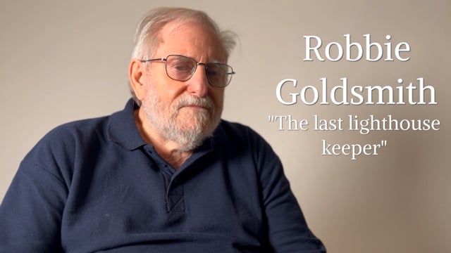
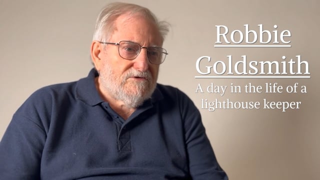
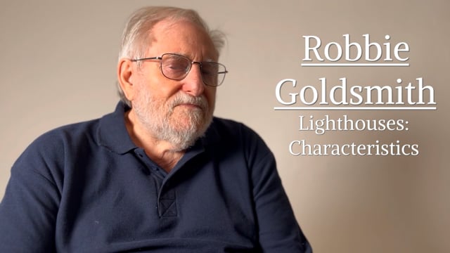
Robbie Goldsmith – The Life of a Lighthouse keeper
(First reported in Les Tortevalais. Issue 24)

“I joined the Army just before my 15th birthday, enlisting in the Junior Leaders Regiment Royal Armoured Corps and later on when reaching 17 served with the 9th/12th Royal Lancers and still later with the Army Air Corps and spent all of my Regular service overseas, mostly in Aden and Yemen and the Trucial Oman States (now called the UAE.)

After 10 years in the Army I left and worked as a lorry driver and then for a short while for Dennis Body Builders in Guildford as a fibreglass laminator.

I found this a bit strange after my Army Service and prior to my leaving the Army I had seen an advert for Lighthouse Keepers in the Soldier magazine, so I decided to apply and so a few weeks later I found myself at Portland Bill Lighthouse learning all the duties.

After a month’s course at Harwich to learn all the basic skills required to be a keeper, i.e. knots, splicing, morse code, signalling, boat work, cooking including baking bread, to name but a few.

I then did a further month’s course at Blackwall workshops in London to learn all the different types of engines and compressors and different types of optics/lens and fog signals. Also, Radio work and having to pass the Governments Radio test to gain my operator’s licence.

Later when we started to use helicopters we had to do survival courses at the Merchant Navy School including simulated escapes from the helicopter under water in the dreaded dunker.

Then I was ready for offshore lighthouses and as a Supernumerary Assistant Keeper. (SAK) did duties at many offshore and Island Lighthouses. As this was in the early 70s some of these lighthouses still used paraffin lamps in the lens so this meant you had to constantly pump the fuel up during your watch and keep the mantel /wicks trimmed.

Also, a lot of these towers had clockwork mechanism to rotate the lens so as the weights descended through a tube in the tower you would need to wind them back up to keep the lens rotating.

I first came to the Hanois Lighthouse in 1972 for two months duty as an SAK.

At that time the relief was carried out from Portelet Harbour on the Trinity house boat called the "Beacon" and the late Mr George Le Couteur was the local boatman and the boat was crewed by his workforce with the late Edwin Martel as the coxswain.

In later years Dick Tostevin took over the duties as the local boatman using his own fishing boat "The Pamela." Both George and Dick were excellent boatmen and although we carried out some hairy reliefs in rough seas at times, we always had confidence in both of them.

We had to take all our own rations out on the boat and we brought these from The Fisherman's Stores in Rocquaine Bay.

After three years as an S.A.K. I was promoted to Assistant Keeper and appointed to the Hanois late in 1973 as the 2nd AK and by then the relief was done by helicopter with the helipad on the rocks, but the relief could only be done at low tide as the pad was covered the rest of the time and sometimes if it was rough we could still not land there as the sea came over at times.

The relief was done from Alderney Lighthouse in a Wessex helicopter belonging to the Coast Guard.

Later on Trinity house got their own helicopter chartered from Bond Helicopters and operated from Guernsey Airport.

Life on the Hanois was a bit hard at times in those early days of the 70s as we did 56 days out there and then had 28 days leave, however if the relief was delayed due to bad weather you could often spend a few extra days out there, which meant you lost part of your 28 days leave.

The Hanois was not one of the best Tower Rock Stations, it was very damp and cold. In the very small kitchen/living room there was a Rayburn coal fire oven on which we cooked our meals and when it was bad weather we had to have all the shutters over the windows closed.

In the morning the keeper on watch had to clean out the old ashes from the fire and throw them out the window so you had to make sure you knew which way the wind was or else you would get them back in your face.

The coal was delivered either by George in the Local boat or by the Trinity House Tenders from East Cowes on the Isle of Wight, as also was the fresh water and oil.

There was no telephone and the only way to contact home was by a radio telephone call via Niton Radio on the Isle of Wight, which used to cost you a fortune.

There was no shower there although there was a flush toilet in the base of the tower in which we used a submersible pump to fill the header tank with seawater. This was a rare luxury for Tower Rock Lighthouse.

The bedroom was very small with 4 bunks, unlike most Tower Lighthouses these were the normal shape and were made up on a sort of scaffolding rig, whereas on all other lighthouse they are banana shaped and curve around the tower wall.

There was a well type tank in the base of the tower in which we held 2000 gallons of fresh water and this was our only water supply and had to be topped up from the Beacon or by the Trinity House Tender with hose's and a pump on the boat. As water was limited we used the water we washed our clothes in to later wash the floors and stairs. All our washing and personal washing had to done in the little kitchen and in there we had the stove, personal food cupboards and a table and chairs and a TV set and the radio speaker which was kept on the distress/calling frequency.

A paraffin fridge was in the base of the tower.

The bedroom was very small with 4 bunks (1 spare for the visiting mechanic) and if two of you stood up in the bedroom you were touching each other.

The lighthouse was electric and we had 3 engines to drive the generators and also two compressors to drive the fog signal which we had to sound if the visibility was less than a mile.

The crew consisted of a Principle Keeper (PK) and two Assistant Keepers (AK's) and the changes were done every 28 days weather permitting, the major relief was when the PK and one AK changed and the minor relief was when just one AK changed.

At these times the crew members remaining for a further month would have a restock of their food as an order would have been passed a few days earlier by radio and Mr Petit from The Fisherman Stores would deliver it to George to bring out on the Beacon.

The watch keeping was split into 4 or 8 hour shifts, which went like this: 4AM until 12 Mid-Day, then 8 hours off watch, back on at 8PM until Midnight, then 12 hours off watch and back on again at 12 Mid-day until 8PM, 4hours off watch and back on again at Midnight until 4AM, then 24 hours free from watch keeping duties, although free from watch keeping you still had other chores to do, like engine maintenance, liming the boat landing and steps plus numerous other mundane duties.

Each night each keeper would put out what meat he would want for his dinner and the morning watchman would supply the vegetables from his own supply and cook the dinner and all three keepers would then have their dinner together and this was really the only time we all sat together and had a good chat, etc.

On Christmas Day 1973 I was on the morning watch and when washing at the kitchen sink I noticed out the window a lot of lights and realised a large vessel was there.

It was the Elwood Mead which had run aground on the Les Grunes de Nord-Ouest Rocks.

I quickly went up to the Service Room to inform St. Peter Port Radio that an Oil Tanker (I later found out it was an Ore Carrier) was aground on the Les Grunes.

The late Albi De Garis was on duty and laughed at me and said Happy Christmas Robbie, seems like you had a little too much last night.

Later when a passing Police Patrol on Guernsey confirmed it the radio became red hot, luckily no one was injured in that accident, unlike like a few days later when the Prosperity sank in Perrile Bay during a violent storm with the tragic loss of all 18 on board.

The reporting of the Elwood Mead's was one of my last contacts with Albi at the time (Although on my return 6 years later we became very good friends)

A few days before I was due to go ashore in January 1974 I was informed that I was being transferred to the Bishop Rock Lighthouse off the Sicily Islands and instructed I was to bring all my personal gear ashore.

So after a few more moves to different offshore lighthouses and a spell at Dungeness Lighthouse on the Kent Coast, 6 years later March 1979 I returned to the Les Hanois as the 1st AK and was given one of the Trinity Cottages to live in along with my wife Pat and our two children Michele and Paul at Pleinmont overlooking Portelet Harbour.

A lot had changed by then, the Rayburn coal stove had gone and had been replaced by a Hamco oil stove/cooker and the coal cellar had been converted into a shower room and we had an electric fridge and washing machine. What Luxuries. However, if someone opened the wrong window in the kitchen there would be an oily blow back from the Hamco Cooker and the kitchen became covered in oily soot.

At the end of 1979 they built the helipad above the lantern and then double manned all lighthouses and changed our tours of duty to 28 days on and 28 days ashore on leave, the reliefs now being every 14 days. The helipad was constructed at the workshops in Blackwall and then brought over here and erected on Station. The noise and dust on the Hanois during the drilling into the granite blocks of the tower was horrendous, but once it was finished and the relief was done by helicopter from Guernsey Airport and on the top of the Lighthouse, the prospect of overdue reliefs was over, only fog stopped the helicopter from coming, we once did a relief in a force 10.

But alas the helicopter pads were the beginning of the end as once you could put men on an empty lighthouse it made automation that much easier as we were later to find out.

The Hanois was normally a two to three year posting and not a popular posting as it was not a nice off sure tower, however as my family and myself loved Guernsey I volunteered to stay so as I could got my housing license, which at the time was 10 years but before I did 10 years it increased to 15 years.

While on the Hanois all the Keepers needed to do something to pass the time, some made models, some fished nearly every day, my friend Alan studied and did the Open University course and got a Bachelors of Arts Degree, sadly he recently passed away with lung cancer.

Myself I operated an amateur radio set and chatted to people all over the world and became a much sort after contact and during a World Contest I came 1st and was a World Champion for a while.

I also put messages in empty bottles and had hundreds of replies, from several countries, one even went to Florida in the USA, however sadly some only went as far as Rocquaine Bay.

I have kept in touch with many of those contacts, both radio and bottle mail.

From 1979 until late 1989 life on the Hanois didn't change much, different Keepers came and went, we had many violent storms including the hurricane of 1987, a few wrecks, one which stands out was the Radiant Med.

During that sad night the seas at the Hanois were reaching the kitchen window, about 60 feet up and they burst through the windows at the lower engine room and washed our stores out and down the stairs.

One night when on the 8 to midnight watch I had to check the batteries that were on charge and unfortunately the rubber hose on the hydrometer had perished and acid squirted into my eye and after frantic radio calls and with the help of Brixham Coast Guard a French helicopter lifted me off at 2AM and I spent the next 6 days in the Princess Elizabeth Hospital, luckily my eye was saved.

Another time I had to be brought ashore to have a raging toothache seen too and Dick was not available so Mick and Colin Smith came to get me off, unfortunately the gear box played up on their boat and we ended up high and dry on the rocks but God was watching over us that day as a large wave took us back out to sea and with Micks excellent boat skills we were able to reach Portelet Harbour.

Another hairy moment was one time in rough seas in December a few days before Christmas and we were getting two maintenance men ashore I got washed off the landing and was lucky to be rescued by Dick.

My most memorial day on the Hanois was on May 21st 1994, my 50th birthday, when my future wife Joy (my marriage to Pat had ended in Divorce) had arranged with Dick Tostevin to bring my Daughter Michele and her husband out along with lots of my friends to have a Champagne birthday party on the Lighthouse, they had painted a large 50 on a sheet and displayed this on the boat, a wonderful surprise and if anyone knows Joy they will know what a wonderful cook she is, so you can imagine the lovely spread of homemade goodies she brought with her for us all to share.

Sadly my son Paul lost his life while recovering his pots in October 1989 in the bay and so Trinity House transferred me to The Casquets Lighthouse and when the Casquets was automated I went to Alderney Lighthouse until I was promoted to Principal Keeper(PK) and returned to the Hanois and eventually ending up doing a grand total of over 14 years on the Hanois, not only a record for the Hanois, but also a record for any Trinity House Lighthouse Keeper to do on a Tower rock lighthouse. I then returned to Alderney as the PK and later took over the Hanois and Casquets as the Lighthouse Keeper/Attendant until I retired from Trinity House in 1997 so then having been the only Keeper to serve on the Hanois as SAK, AK, PK and Lighthouse Keeper/Attendant.”

I then worked for the States of Guernsey as a Residential Child Care Officer with the Children's Board and finally retired at the ripe old age of 69 two years ago.”

Robbie Goldsmith
Robbie Goldsmith

Robbie Goldsmith and his time on Hanois Lighthouse
(first reported in So West Magazine)

“I joined Trinity House Lighthouse Service in 1971 and first came to the Les Hanois as an Assistant Keeper in 1972. It was my 5th offshore Tower rock lighthouse having done previous duties on the Needles, Beachy Head, The Nab Tower and the Royal Sovereign Light Tower as well as many Island and shore stations, but the Les Hanois was different in many ways, there was no shower and only 2000 gallons of fresh water in a tank sunk in the base of the tower, which had to last for a month, and it was a very damp place to live.

Each morning when you got up you would bring your bedding down into the kitchen (as there was a Rayburn Coal fire/cooker) so it would be dry when you went to bed. We later used sleeping-bags. I left the Les Hanois January 1974 on being transferred to Bishop Rock Lighthouse and later spent several years at Dungeness Lighthouse and other lighthouses before returning to the Les Hanois in March 1979.

It was still a very damp place but the Rayburn had gone and we now had an oil fuelled Hamco stove, so the coal cellar had been converted into a shower room and we had a flush toilet and a submersible pump to fill the header tank up with seawater.

If you opened the wrong window in the kitchen you would get a blow back from the hamco stove and the kitchen would fill with oily sooty smoke.

At one time we had a mechanic on station and we had cooked dinner, his as well and called him to come and eat, he said its stuffy in here and although we said "No! don't open that window" he didn't listen so the four of us ended up covered in oily soot and the meal and table were likewise covered.

We had some good days on the Hanois, catching crabs and lobsters in our pots and on calm days at low tides pulling large crabs out of the many holes in the rocks, however I only ever found 1 ormer out there.

We saw some lovely sunrises and sunsets and had some lovely days sunbathing at times and others battened down for days during the raging gales and storms.

At first the reliefs were done by boat from Portelet harbour by George Le Couteur and his work force in the Trinity House boat The Beacon (Later Dick Tostevin took over in his own boat.) and at that time we spent 56 days out there before coming ashore for 28 days leave. Later the reliefs were done by helicopter and after 1979 when the helipad was built on the top of the lighthouse we only had to do 28 days there before being relieved and spending 28 days ashore.

There were 3 keepers on the lighthouse all the time and we all had to take our own supplies out with us.

The morning watchman would also be the duty cook so would prepare the dinner using his own vegetable's and the other two keepers would have got their meat from the paraffin fridge at the base of the tower before going to bed and the morning watchman would cook it along with his own. Dinner time (midday) was the only real time all three of us got together, after dinner we often played crib for an hour or so.

We did different things to pass the time when not on watch, some fished most of the time, my friend Alan studied the Open University course and gain a BA, others made models, I operated an amateur radio set and also put messages in bottles and had many replies, one made it as far as Florida USA, but some only got as far as Rocquaine Bay

At the end of 1989 I was transferred to the Les Casquets Lighthouse and when that was automated on to Alderney Lighthouse and the on promotion to Principal returned to the Les Hanois. In the end I did a record 14 years on the Les Hanois Lighthouse.

Robbie Goldsmith
Robbie Goldsmith

Robbie Goldsmith and his time on Les Casquets Lighthouse
(First reported in Les Tortevalais. Issue 26)

I joined Trinity House in 1971 and in 1972 on my 2nd trip to The Channel Islands as a Supernumerary Assistant Keeper I was sent to Les Casquets Lighthouse having already spent 2 months on the Les Hanois Lighthouse a few months previously.

I flew from Southampton on a Trilander to Alderney and spent the night in a guest house before reporting the following morning to Nick Allen with all my supplies at the Divers Inn, as Nick was the local boatman for The Les Casquets at that time and was also the Trinity House pilot following a long tradition of that family.

I was made welcome in the Divers but was soon a few pounds (£s) out of pocket as I had spotted a 50 pence piece on the floor and when I tried to retrieve it I found it was glued to the floor and much to the joy of the locals in the bar I was informed that it was the tradition of those caught to buy a round of drinks.

We later made our way down to Nicks boat and were soon on our way in a force 5 and choppy seas out to the Lighthouse.

The Les Casquets looked quite formidable as we approached with a lot of white water around the landing, however a perfect relief was achieved and I soon had the daunting task of getting my supplies up a 60-foot incline/hill to the lighthouse.

However half way up was a mono rail with a petrol driven train and all the stores and supplies were placed on this and the steepest part of the climb was completed a lot easier.

I was very impressed when arriving in the court yard as it seemed like a family dwelling and the living quarters were excellent after having spent time on other offshore Lighthouses like The Nab Tower, Beachy Head, The Needles and not to mention the Les Hanois these conditions were very welcome.

Each Keeper had his own bedroom, there was a bathroom and flush toilet, a dining room, kitchen and sitting room with armchairs and a TV Not all Lighthouse's had TV's in those days) and there was another dwelling attached to the keeper’s quarters for visiting mechanics/engineers to use. There was also a large workshop building. There was also a deep freeze and a washing machine.

The Les Casquets consisted of 3 towers, one housed the main optic (The light) another housed the Radio Beacon and the engines and the 3rd housed the fog signal and compressors. So, there was a lot more to look after than on the Towers that I had been on before.

We even had a little green house a little way down the rocky outcrop in which fresh veg could be grown.

As one approached the dwellings from the boat landing there was the remains of an old German Anti Air Craft gun which the Keepers kept nicely painted black and, in the courtyard, painted on the concrete was the four points of the compass and this had been painted there by the Germans during the occupation and the North was shown as a large O, the keepers also kept this painted in black too.

My 28 days quarterly relief duty passed peacefully and I enjoyed my stay there.

I later returned in 1973 for a two month stay when a Keeper had been taken ill and I was sent to relieve him.

This time I went by Helicopter from Alderney Lighthouse as a helipad had been built on the lower rocks, which did away with carrying all those stores from the boat landing as the helipad was close to the mono rail.

That was the last time I saw the Les Casquets Lighthouse until 17 years later when in January 1990 I was transferred there from the Les Hanois,

Relief was done from Guernsey Airport by helicopter and by then a new helipad had been built on top of the Radio Beacon tower as the lower one on the rocks was covered at high water. I was to spend from January until November there (28 days on and 28 days ashore) until the Les Casquets was automated in November 1990

The television we had out there went wrong so we hired one from Channel Rentals from Guernsey, however it was delivered on the helicopter during a very bad storm, a gale 8 and gusting a good 9 at times and unfortunately it was blown off the helipad and smashed. This was later replaced, but as the remote was not lost we now had two remote controls which gave us a lot of fun as the Principal Keeper at the time used to love spending his afternoons watching TV so with him not knowing about the spare remote we used to change channels or turn it on or off from outside the window and he kept complaining that there was something wrong with it. :-)

During my time there we did not have any wrecks to report.

However, it was a very busy time and the place was full of mechanics/engineers and workmen as during the whole of 1990 the Casquets was being changed to automatic and the place was like a bomb site with the workshop being knocked down along with several boundary walls so we twinned it with Beirut where at the time there was a civil war taking place.

Following the automation in November I was then posted to Alderney Lighthouse from where the Les Casquets was monitored by computer and every month two of the Keepers from Alderney would go and do the maintenance and husbandry out there. I was later promoted to Principal Keeper and returned to the Les Hanois Lighthouse and on the automation of the Hanois I became the Lighthouse Keeper/Attendant for both Les Casquets and Les Hanois so I spent several more times there.

One of the times later in the late 90s as the attendant I spent a month out on the Casquets with 3 painters and helped to paint the Red Bands around the tower when it had been decided it would stand out better as a day mark as up until then it had always been painted all white.

During that stay, one night we had an horrendous storm, a force 9 gusting 10/11 at times and the sea was coming through the court yard (60 Feet up) and did a lot of structural damage and also ripped out the cabinet for the coupling pipes on the boat landing where the Lighthouse tender vessels used to deliver oil and fresh water. It was impossible to venture out the dwelling during that storm.

During this storm my wife ashore phoned to tell me about how rough the seas were in Rocquaine Bay, I had to smile as I replied "Tell me about it"

The Les Casquets was a very nice posting and I enjoyed my time there as there was lots to keep you occupied as well as the vast amount of different migrating birds that passed through, the family of seals which often bathed on the lower helipad and the nesting gulls amongst the rocks.

I finally retired from Trinity House in 1997.”

Robbie Goldsmith
Robbie Goldsmith

YouTube footage (supplied by Robbie Goldsmith)
https://www.youtube.com/watch?v=ySkWUwgbH4M

Bailiwick Express article about YouTube video
https://gsy.bailiwickexpress.com/gsy/news/lighthouse-film


Messages in a Bottle

Whilst on the Hanois, Robbie sent many hundreds of messages in a bottle and people who found them started writing to him. See below for some more information about what happened to some of the bottles, one was found over 25 years from the date it was dropped in the ocean!

  1. Relationship
    https://www.mirror.co.uk/news/uk-news/how-lonely-lighthouse-keepers-message-12535008
  2. Bottle found after 25 years
    Message in a bottle found after 25 years | Guernsey Press

History Quiz

Think you know your Lihou history? Answer these questions!

1) The earliest people on Lihou were from which period?

2) The Priory on Lihou was built in the 12th Century by which order?

3) The historic fish traps on Lihou Island are typically how wide?

4) How many people were recorded as living on Lihou in the 1841 Census?

5) In the 1880s, Lihou became a major supplier for which industry?

6) The Channel Islands were the only British territories occupied by Nazi Germany during WWII from ____ to ____:

7) Colonel Wootton purchased Lihou Island in which year?

8) Lihou’s stone causeway is approximately how many metres long?

Lihou Island Museum and Education Centre

The Journey

Current warden, Steve Sarre, first came to the Appleby offices in October 2022 to talk to the Appleby CSR team about how we could get more involved with the Lihou Charity LBG. Prior to this, Appleby’s involvement with the charity had consisted of manning a slot at the West Show car park (which generates significant funds for the charity) and sponsoring and attending some events that the Friends of Lihou organise at various times of the year to help raise valuable funds for the charity.

Once Steve started to regale us about the rich and varied history of Lihou Island the concept of a museum to tell the story of Lihou was born!

A key part of the great work the charity does is to offer educational residentials to every school child across the Bailiwick of Guernsey. Steve and the Appleby team could see how a museum and education centre would work well with the educational activities that Steve and previous wardens of Lihou undertake as part of every school's trip to Lihou Island.  

And thus, the journey began.

We have spent time researching the most important eras in Lihou’s history, trying to determine how best to organise and showcase this took some time. The island’s history is extraordinary. For a small tidal peninsula on the edge of the Atlantic, it has a rich and vast history spanning many important dates in the history of mankind. We have also managed to curate a small collection of artefacts.

In addition to the actual history of the island, Steve noted that when the schools come to visit he is also keen to share information about the island’s natural habitat and wildlife. We took this on board and extended the remit of the museum to include information about the island’s fauna, flora and sea life. We have added information about the tides, RAMSAR sites and local places of interest including the lighthouses. Along our way we were also fortunate to record some social history by interviewing the last remaining lighthouse keeper who worked on all of the neighbouring lighthouses in the days before they were automated.

We hope you enjoy this museum and education centre as much as we have enjoyed creating it and that its legacy lasts for many years to come. For those of you who cannot get over to Lihou to visit our museum we have made much of our research available to see on this website.

There have been some challenges along the way, foremost the accessibility of Lihou from mainland Guernsey. Battling the elements, the often-short periods the causeway is open and transporting everything across all required planning, patience and a great deal of hard work.

We were fortunate to find a team of master craftsmen to make our vision into a reality and we would like to thank the following people for being part of this fantastic journey:

  • Stuart Harrison, Lisa Upham and the Appleby team
  • Steve Sarre, Warden of Lihou
  • Dr Philip de Jersey FSA, States Archaeologist
  • Dowding Signs
  • ESG Electrical Contractors
  • James Colmer Art & Design
  • Swan Joinery
  • Simon Harvey (Lihou website)
  • Robbie Goldsmith (Former Guernsey lighthouse keeper)
  • Anjali Ayres and The Sixth Form Centre
  • The States of Guernsey Culture and Heritage team